★ 2965 pts. ♥ 0 aime ⬇ 5 sauvegardés
![[Wtf] Google Maps Satellite view of a dead body (#Wtf #Body #Dead #Google #Maps #Satellite) - 165 KB Tags: body, dead, google, maps, satellite, wtf (Pict. in My r/WTF favs)](https://t.im9.eu/wtf-google-maps-satellite-view-of-a-dead-body.jpg) Pict. mapporn-some-of-the-most-hazardous-places-in-the-world-838-612 (#World #Map #Wide #Usa #Asia #Geography #Statistics)Pict. 838×612 px
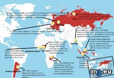
Pict. mapporn-some-of-the-most-hazardous-places-in-the-world-838-612 (#World #Map #Wide #Usa #Asia #Geography #Statistics)Pict. 838×612 px★ 7171 pts. ♥ 0 aime ⬇ 4 sauvegardés
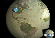
 Pict. mapporn-all-the-water-on-earth-presented-as-a-sphere-it-would-have-a-diameter-of-about-860-miles-and-a-volume-around-332-500-000-cubic-miles-1600-1534 (#White #World #Map #Best #Europe #Water #Miles #Geography #Statistics #Presented #Diameter #Sphere #Cubic)Pict. 950×911 px
★ 10k pts. ♥ 0 aime ⬇ 5 sauvegardés
 Pict. [Mildlyinteresting] The Google Maps car covered every aisle of this parking lot. (#Car #Lot #Maps #Parking #Aisle)Pict. 882×574 px
★ -11042 pts. ♥ 0 aime ⬇ 5 sauvegardés
![[Mildlyinteresting] The Google Maps car covered every aisle of this parking lot. (#Car #Lot #Maps #Parking #Aisle) - 105 KB Tags: aisle, car, covered, google, lot, maps, parking (Pict. in My r/MILDLYINTERESTING favs)](https://t.im9.eu/mildlyinteresting-the-google-maps-car-covered-every-aisle-of-this-parking-lot.jpg) Pict. Europe history (Polandball meme style flags maps) (#Map #Europe #Meme #Maps #Poland #Flags #Polandball)Pict. 560×6186 px
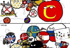
Pict. Europe history (Polandball meme style flags maps) (#Map #Europe #Meme #Maps #Poland #Flags #Polandball)Pict. 560×6186 px★ 8549 pts. ♥ 0 aime ⬇ 9 sauvegardés
 Pict. [Mapporn] Big U.S. cities' populations squeezed into NYC. Spoiler alert: NYC is big. More maps in comments. [2652x2582] (#Big #Nyc #Maps #Squeezed #Spoiler)Pict. 2652×2582 px
★ 6710 pts. ♥ 0 aime ⬇ 9 sauvegardés
![[Mapporn] Big U.S. cities' populations squeezed into NYC. Spoiler alert: NYC is big. More maps in comments. [2652x2582] (#Big #Nyc #Maps #Squeezed #Spoiler) - 335 KB Tags: alert, big, cities, maps, nyc, populations, spoiler, squeezed (Pict. in My r/MAPS favs)](https://t.im9.eu/mapporn-big-u-s-cities-populations-squeezed-into-nyc-spoiler-alert-nyc-is-big-more-maps-in-comments-2652x2582.jpg) Pict. [Mapporn] Design your own customized maps. This is Amsterdam [768x1024] (#Design #Maps #Amsterdam)Pict. 768×1024 px
Pict. [Mapporn] Design your own customized maps. This is Amsterdam [768x1024] (#Design #Maps #Amsterdam)Pict. 768×1024 px★ 5075 pts. ♥ 0 aime ⬇ 9 sauvegardés
![[Mapporn] Design your own customized maps. This is Amsterdam [768x1024] (#Design #Maps #Amsterdam) - 264 KB Tags: amsterdam, design, maps (Pict. in My r/MAPS favs)](https://t.im9.eu/mapporn-design-your-own-customized-maps-this-is-amsterdam-768x1024.jpg) Pict. [Mapporn] Maps from the official MH17 crash investigation [1125x2536] (#Maps #Official #Crash #Mh17)Pict. 1124×2536 px
Pict. [Mapporn] Maps from the official MH17 crash investigation [1125x2536] (#Maps #Official #Crash #Mh17)Pict. 1124×2536 px★ 5116 pts. ♥ 0 aime ⬇ 8 sauvegardés
![[Mapporn] Maps from the official MH17 crash investigation [1125x2536] (#Maps #Official #Crash #Mh17) - 456 KB Tags: crash, maps, mh17, official (Pict. in My r/MAPS favs)](https://t.im9.eu/mapporn-maps-from-the-official-mh17-crash-investigation-1125x2536.jpg) Pict. [Mapporn] Border Uncertainties: 1920 Map Published During Polish-Soviet War and Before Signing of Trianon Treaty (More maps in c (#Map #Polish #Soviet #Published #Signing)Pict. 3984×2241 px
Pict. [Mapporn] Border Uncertainties: 1920 Map Published During Polish-Soviet War and Before Signing of Trianon Treaty (More maps in c (#Map #Polish #Soviet #Published #Signing)Pict. 3984×2241 px★ 6139 pts. ♥ 0 aime ⬇ 8 sauvegardés
![[Mapporn] Border Uncertainties: 1920 Map Published During Polish-Soviet War and Before Signing of Trianon Treaty (More maps in c (#Map #Polish #Soviet #Published #Signing) - 1.2 MB Tags: map, maps, polish, published, signing, soviet, war (Pict. in My r/MAPS favs)](https://t.im9.eu/mapporn-border-uncertainties-1920-map-published-during-polish-soviet-war-and-before-signing-of-trianon-treaty-more-maps-in-comments-3984x2241.jpg) Pict. [Mapporn] Comparative Maps Of The 2011 Canadian Federal Election Of The Seat Distribution Under FPTP Voting And What It Would Ha (#Canadian #Maps #Distribution #Voting #Federal)Pict. 3300×3268 px
Pict. [Mapporn] Comparative Maps Of The 2011 Canadian Federal Election Of The Seat Distribution Under FPTP Voting And What It Would Ha (#Canadian #Maps #Distribution #Voting #Federal)Pict. 3300×3268 px★ 6566 pts. ♥ 0 aime ⬇ 8 sauvegardés
![[Mapporn] Comparative Maps Of The 2011 Canadian Federal Election Of The Seat Distribution Under FPTP Voting And What It Would Ha (#Canadian #Maps #Distribution #Voting #Federal) - 417 KB Tags: canadian, distribution, election, federal, maps, seat, voting (Pict. in My r/MAPS favs)](https://t.im9.eu/mapporn-comparative-maps-of-the-2011-canadian-federal-election-of-the-seat-distribution-under-fptp-voting-and-what-it-would-have-been-under-proportional-voting-3300x3268.jpg) Pict. [Mapporn] States & Provinces That Have Had 'Subjective Maps' of Them Posted This Month (So Far) [1980x2400] (#Far #Posted #States #Month #Maps #Provinces)Pict. 1980×2400 px
Pict. [Mapporn] States & Provinces That Have Had 'Subjective Maps' of Them Posted This Month (So Far) [1980x2400] (#Far #Posted #States #Month #Maps #Provinces)Pict. 1980×2400 px★ 5670 pts. ♥ 0 aime ⬇ 12 sauvegardés
![[Mapporn] States & Provinces That Have Had 'Subjective Maps' of Them Posted This Month (So Far) [1980x2400] (#Far #Posted #States #Month #Maps #Provinces) - 272 KB Tags: far, maps, month, posted, provinces, states (Pict. in My r/MAPS favs)](https://t.im9.eu/mapporn-states-provinces-that-have-had-subjective-maps-of-them-posted-this-month-so-far-1980x2400.jpg) Pict. [Mapporn] [1380x1206] I Make Artistic Maps For Civilization V. This One Is An Updated Map For Spain Under Isabella. (#One #Map #Updated #Isabella #Civilization)Pict. 1206×1380 px
Pict. [Mapporn] [1380x1206] I Make Artistic Maps For Civilization V. This One Is An Updated Map For Spain Under Isabella. (#One #Map #Updated #Isabella #Civilization)Pict. 1206×1380 px★ 7118 pts. ♥ 0 aime ⬇ 10 sauvegardés
![[Mapporn] [1380x1206] I Make Artistic Maps For Civilization V. This One Is An Updated Map For Spain Under Isabella. (#One #Map #Updated #Isabella #Civilization) - 383 KB Tags: artistic, civilization, isabella, map, maps, one, spain, updated (Pict. in My r/MAPS favs)](https://t.im9.eu/mapporn-1380x1206-i-make-artistic-maps-for-civilization-v-this-one-is-an-updated-map-for-spain-under-isabella.jpg) Pict. [Mapporn] The southern maps I drew for my D&D world (3180X2220) Tell me what you think! (#World #Maps #Drew #Southern)Pict. 3180×2220 px
Pict. [Mapporn] The southern maps I drew for my D&D world (3180X2220) Tell me what you think! (#World #Maps #Drew #Southern)Pict. 3180×2220 px★ 5014 pts. ♥ 0 aime ⬇ 8 sauvegardés
![[Mapporn] The southern maps I drew for my D&D world (3180X2220) Tell me what you think! (#World #Maps #Drew #Southern) - 936 KB Tags: drew, maps, southern, world (Pict. in My r/MAPS favs)](https://t.im9.eu/mapporn-the-southern-maps-i-drew-for-my-d-d-world-3180x2220-tell-me-what-you-think.jpg) Pict. [Mapporn] Google Maps lets you play PacMan anywhere. [1,015x609] (#Play #Google #Maps)Pict. 1015×609 px
Pict. [Mapporn] Google Maps lets you play PacMan anywhere. [1,015x609] (#Play #Google #Maps)Pict. 1015×609 px★ 4311 pts. ♥ 0 aime ⬇ 3 sauvegardés
![[Mapporn] Google Maps lets you play PacMan anywhere. [1,015x609] (#Play #Google #Maps) - 85 KB Tags: google, maps, play (Pict. in My r/MAPS favs)](https://t.im9.eu/mapporn-google-maps-lets-you-play-pacman-anywhere-1-015x609.jpg) Pict. [Mapporn] We've all seen maps of landlocked countries...here's a map of landlocked first level administrative divisions [4972x25 (#Map #Countries #Divisions #Administrative #Landlocked)Pict. 4972×2517 px
Pict. [Mapporn] We've all seen maps of landlocked countries...here's a map of landlocked first level administrative divisions [4972x25 (#Map #Countries #Divisions #Administrative #Landlocked)Pict. 4972×2517 px★ 7116 pts. ♥ 0 aime ⬇ 10 sauvegardés
![[Mapporn] We've all seen maps of landlocked countries...here's a map of landlocked first level administrative divisions [4972x25 (#Map #Countries #Divisions #Administrative #Landlocked) - 261 KB Tags: administrative, countries, divisions, landlocked, level, map, maps (Pict. in My r/MAPS favs)](https://t.im9.eu/mapporn-we-ve-all-seen-maps-of-landlocked-countries-here-s-a-map-of-landlocked-first-level-administrative-divisions-4972x2517.jpg) Pict. [Mapporn] Paris night and day traffic noise maps 2015 [ 960x640 ] 2 (#Day #Night #Traffic #Noise #960x640)Pict. 960×640 px
Pict. [Mapporn] Paris night and day traffic noise maps 2015 [ 960x640 ] 2 (#Day #Night #Traffic #Noise #960x640)Pict. 960×640 px★ 5771 pts. ♥ 0 aime ⬇ 15 sauvegardés
![[Mapporn] Paris night and day traffic noise maps 2015 [ 960x640 ] 2 (#Day #Night #Traffic #Noise #960x640) - 208 KB Tags: 960x640, day, maps, night, noise, paris, traffic (Pict. in My r/MAPS favs)](https://t.im9.eu/mapporn-paris-night-and-day-traffic-noise-maps-2015-960x640-2.jpg) Pict. [Mapporn] Paris night and day traffic noise maps 2015 [ 960x640 ] 1 (#Day #Night #Traffic #Noise #960x640)Pict. 960×640 px
Pict. [Mapporn] Paris night and day traffic noise maps 2015 [ 960x640 ] 1 (#Day #Night #Traffic #Noise #960x640)Pict. 960×640 px★ 5704 pts. ♥ 0 aime ⬇ 12 sauvegardés
![[Mapporn] Paris night and day traffic noise maps 2015 [ 960x640 ] 1 (#Day #Night #Traffic #Noise #960x640) - 184 KB Tags: 960x640, day, maps, night, noise, paris, traffic (Pict. in My r/MAPS favs)](https://t.im9.eu/mapporn-paris-night-and-day-traffic-noise-maps-2015-960x640-1.jpg) Pict. [Mapporn] Map of North America in the style of Tolkien's Middle-Earth maps (lotr) [1000x1200] (#Map #North #Earth #Lotr #Tolkien)Pict. 1000×1200 px
Pict. [Mapporn] Map of North America in the style of Tolkien's Middle-Earth maps (lotr) [1000x1200] (#Map #North #Earth #Lotr #Tolkien)Pict. 1000×1200 px★ 6245 pts. ♥ 0 aime ⬇ 3 sauvegardés
![[Mapporn] Map of North America in the style of Tolkien's Middle-Earth maps (lotr) [1000x1200] (#Map #North #Earth #Lotr #Tolkien) - 217 KB Tags: america, earth, lotr, map, maps, north, style, tolkien (Pict. in My r/MAPS favs)](https://t.im9.eu/mapporn-map-of-north-america-in-the-style-of-tolkien-s-middle-earth-maps-lotr-1000x1200.jpg) Pict. [Mapporn] Updated Google Maps Middle Earth [3600x2700] (#Updated #Earth #Google #Maps)Pict. 3600×2700 px
Pict. [Mapporn] Updated Google Maps Middle Earth [3600x2700] (#Updated #Earth #Google #Maps)Pict. 3600×2700 px★ 4891 pts. ♥ 0 aime ⬇ 3 sauvegardés
![[Mapporn] Updated Google Maps Middle Earth [3600x2700] (#Updated #Earth #Google #Maps) - 780 KB Tags: earth, google, maps, updated (Pict. in My r/MAPS favs)](https://t.im9.eu/mapporn-updated-google-maps-middle-earth-3600x2700.jpg) Pict. maps-and-keys-chart (#Maps #Chart #Keys)Pict. 603×735 px
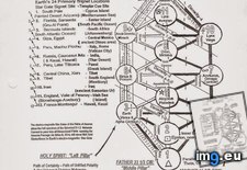
Pict. maps-and-keys-chart (#Maps #Chart #Keys)Pict. 603×735 px★ 1827 pts. ♥ 0 aime ⬇ 9 sauvegardés
 Pict. [Mapporn] Battle of Monte Cassino. 1944. + google maps [1439x814] (#Battle #Google #Maps #Monte)Pict. 1439×814 px
★ 4740 pts. ♥ 0 aime ⬇ 3 sauvegardés
![[Mapporn] Battle of Monte Cassino. 1944. + google maps [1439x814] (#Battle #Google #Maps #Monte) - 359 KB Tags: battle, google, maps, monte (Pict. in My r/MAPS favs)](https://t.im9.eu/mapporn-battle-of-monte-cassino-1944-google-maps-1439x814.jpg) Pict. meanwhile in maps ( #Maps)Pict. 1098×611 px
Pict. meanwhile in maps ( #Maps)Pict. 1098×611 px★ -3139 pts. ♥ 0 aime ⬇ 0 sauvegardés
 Pict. [Mapporn] Two maps: [left] Results of the 1918 General Election which led to the Irish War of Independence, [right] the modern U (#Two #General #Left #War #Irish #Led #Independence)Pict. 1860×996 px
★ 7749 pts. ♥ 0 aime ⬇ 8 sauvegardés
![[Mapporn] Two maps: [left] Results of the 1918 General Election which led to the Irish War of Independence, [right] the modern U (#Two #General #Left #War #Irish #Led #Independence) - 245 KB Tags: election, general, independence, irish, led, left, maps, modern, results, two, war (Pict. in My r/MAPS favs)](https://t.im9.eu/mapporn-two-maps-left-results-of-the-1918-general-election-which-led-to-the-irish-war-of-independence-right-the-modern-uk-ireland-border-1860x996.jpg) Pict. [Mapporn] Protest Maps and the Power of Cartography, ”‘Citywide pattern of children’s pedestrian deaths and injuries by automobi (#Power #Children #Maps #Injuries #Pedestrian)Pict. 1001×1166 px
Pict. [Mapporn] Protest Maps and the Power of Cartography, ”‘Citywide pattern of children’s pedestrian deaths and injuries by automobi (#Power #Children #Maps #Injuries #Pedestrian)Pict. 1001×1166 px★ 6943 pts. ♥ 0 aime ⬇ 6 sauvegardés
![[Mapporn] Protest Maps and the Power of Cartography, ”‘Citywide pattern of children’s pedestrian deaths and injuries by automobi (#Power #Children #Maps #Injuries #Pedestrian) - 264 KB Tags: children, deaths, injuries, maps, pattern, pedestrian, power, protest (Pict. in My r/MAPS favs)](https://t.im9.eu/mapporn-protest-maps-and-the-power-of-cartography-citywide-pattern-of-children-s-pedestrian-deaths-and-injuries-by-automobiles-or-where-commuters-run-over-black-children-on-the-pointesdowntown-track-article-in-comments-1001x1166.jpg)