★ 6147 pts. ♥ 0 aime ⬇ 5 sauvegardés
![[Mapporn] Europe map with the first image result when searching '[country] guy]' [OC] [1924x1409] (#Image #Guy #Country #Result #Searching) - 362 KB Tags: country, europe, guy, image, map, result, searching (Pict. in My r/MAPS favs)](https://t.im9.eu/mapporn-europe-map-with-the-first-image-result-when-searching-country-guy-oc-1924x1409.jpg) Pict. [Mapporn] Map of Pangea with modern borders[1027x1019] (#Map #Modern #Borders)Pict. 1600×1587 px
Pict. [Mapporn] Map of Pangea with modern borders[1027x1019] (#Map #Modern #Borders)Pict. 1600×1587 px★ 4699 pts. ♥ 0 aime ⬇ 7 sauvegardés
![[Mapporn] Map of Pangea with modern borders[1027x1019] (#Map #Modern #Borders) - 376 KB Tags: borders, map, modern (Pict. in My r/MAPS favs)](https://t.im9.eu/mapporn-map-of-pangea-with-modern-borders-1027x1019.jpg) Pict. [Mapporn] World Religion Map by National Subdivision [4432x2144][OC] (#World #Map #National #Religion #Subdivision)Pict. 4432×2144 px
Pict. [Mapporn] World Religion Map by National Subdivision [4432x2144][OC] (#World #Map #National #Religion #Subdivision)Pict. 4432×2144 px★ 5918 pts. ♥ 0 aime ⬇ 4 sauvegardés
![[Mapporn] World Religion Map by National Subdivision [4432x2144][OC] (#World #Map #National #Religion #Subdivision) - 1011 KB Tags: map, national, religion, subdivision, world (Pict. in My r/MAPS favs)](https://t.im9.eu/mapporn-world-religion-map-by-national-subdivision-4432x2144-oc.jpg) Pict. [Mapporn] A map of the 2009 Black Saturday bushfires, the worst fires in Australia's history [1600x1535] (#Black #Map #Saturday #Worst #Fires)Pict. 1600×1535 px
Pict. [Mapporn] A map of the 2009 Black Saturday bushfires, the worst fires in Australia's history [1600x1535] (#Black #Map #Saturday #Worst #Fires)Pict. 1600×1535 px★ 6108 pts. ♥ 0 aime ⬇ 6 sauvegardés
![[Mapporn] A map of the 2009 Black Saturday bushfires, the worst fires in Australia's history [1600x1535] (#Black #Map #Saturday #Worst #Fires) - 404 KB Tags: australia, black, fires, history, map, saturday, worst (Pict. in My r/MAPS favs)](https://t.im9.eu/mapporn-a-map-of-the-2009-black-saturday-bushfires-the-worst-fires-in-australia-s-history-1600x1535.jpg) Pict. [Mapporn] Map of countries whose flags contain red or blue (by -u-piejezu) [1392x682] (vexillology) (#Map #Red #Flags #Piejezu #Vexillology)Pict. 1392×682 px
Pict. [Mapporn] Map of countries whose flags contain red or blue (by -u-piejezu) [1392x682] (vexillology) (#Map #Red #Flags #Piejezu #Vexillology)Pict. 1392×682 px★ 5873 pts. ♥ 0 aime ⬇ 2 sauvegardés
![[Mapporn] Map of countries whose flags contain red or blue (by -u-piejezu) [1392x682] (vexillology) (#Map #Red #Flags #Piejezu #Vexillology) - 129 KB Tags: blue, countries, flags, map, piejezu, red, vexillology (Pict. in My r/MAPS favs)](https://t.im9.eu/mapporn-map-of-countries-whose-flags-contain-red-or-blue-by-u-piejezu-1392x682-vexillology.jpg) Pict. [Mapporn] Map of the Boston area made by the Soviet military in the 1950's [3600×3774] (#Map #Area #Military #Soviet #Boston)Pict. 3600×3774 px
Pict. [Mapporn] Map of the Boston area made by the Soviet military in the 1950's [3600×3774] (#Map #Area #Military #Soviet #Boston)Pict. 3600×3774 px★ 5408 pts. ♥ 0 aime ⬇ 7 sauvegardés
![[Mapporn] Map of the Boston area made by the Soviet military in the 1950's [3600×3774] (#Map #Area #Military #Soviet #Boston) - 1.5 MB Tags: area, boston, map, military, soviet (Pict. in My r/MAPS favs)](https://t.im9.eu/mapporn-map-of-the-boston-area-made-by-the-soviet-military-in-the-1950-s-3600-3774.jpg) Pict. [Mapporn] Highly detailed world religion map [6000x3048] (#World #Map #Detailed #Religion #Highly)Pict. 6000×3048 px
Pict. [Mapporn] Highly detailed world religion map [6000x3048] (#World #Map #Detailed #Religion #Highly)Pict. 6000×3048 px★ 6189 pts. ♥ 0 aime ⬇ 9 sauvegardés
![[Mapporn] Highly detailed world religion map [6000x3048] (#World #Map #Detailed #Religion #Highly) - 1.2 MB Tags: detailed, highly, map, religion, world (Pict. in My r/MAPS favs)](https://t.im9.eu/mapporn-highly-detailed-world-religion-map-6000x3048.jpg) Pict. [Mapporn] 'Small, but our own', a map of the short lived Second Czechoslovak Republic, after the Munich Agreement. [1200x559] (#Small #Map #Short #Agreement #Czechoslovak)Pict. 1200×559 px
Pict. [Mapporn] 'Small, but our own', a map of the short lived Second Czechoslovak Republic, after the Munich Agreement. [1200x559] (#Small #Map #Short #Agreement #Czechoslovak)Pict. 1200×559 px★ 6683 pts. ♥ 0 aime ⬇ 2 sauvegardés
![[Mapporn] 'Small, but our own', a map of the short lived Second Czechoslovak Republic, after the Munich Agreement. [1200x559] (#Small #Map #Short #Agreement #Czechoslovak) - 307 KB Tags: agreement, czechoslovak, lived, map, munich, republic, short, small (Pict. in My r/MAPS favs)](https://t.im9.eu/mapporn-small-but-our-own-a-map-of-the-short-lived-second-czechoslovak-republic-after-the-munich-agreement-1200x559.jpg) GIF [Mapporn] A map of US states and territories changing over time (gif) [1000x677] (#Gif #Time #Map #States #Changing #Territories)GIF 1000×677 px
GIF [Mapporn] A map of US states and territories changing over time (gif) [1000x677] (#Gif #Time #Map #States #Changing #Territories)GIF 1000×677 px★ 5976 pts. ♥ 0 aime ⬇ 7 sauvegardés
![[Mapporn] A map of US states and territories changing over time (gif) [1000x677] (#Gif #Time #Map #States #Changing #Territories) - 5.8 MB Tags: changing, gif, map, states, territories, time (GIF in My r/MAPS favs)](https://t.im9.eu/mapporn-a-map-of-us-states-and-territories-changing-over-time-gif-1000x677.jpg) Pict. [Mapporn] Geological Map of the Corson Mine, Nottingham Rockingham County, New Hampshire - [4419x3289] (#Map #County #Hampshire #Geological)Pict. 4419×3289 px
Pict. [Mapporn] Geological Map of the Corson Mine, Nottingham Rockingham County, New Hampshire - [4419x3289] (#Map #County #Hampshire #Geological)Pict. 4419×3289 px★ 5408 pts. ♥ 0 aime ⬇ 9 sauvegardés
![[Mapporn] Geological Map of the Corson Mine, Nottingham Rockingham County, New Hampshire - [4419x3289] (#Map #County #Hampshire #Geological) - 618 KB Tags: county, geological, hampshire, map (Pict. in My r/MAPS favs)](https://t.im9.eu/mapporn-geological-map-of-the-corson-mine-nottingham-rockingham-county-new-hampshire-4419x3289.jpg) Pict. [Mapporn] Map of gold production by country [2000x1030] (#Map #Country #Gold #Production)Pict. 2000×1030 px
Pict. [Mapporn] Map of gold production by country [2000x1030] (#Map #Country #Gold #Production)Pict. 2000×1030 px★ 4984 pts. ♥ 0 aime ⬇ 4 sauvegardés
![[Mapporn] Map of gold production by country [2000x1030] (#Map #Country #Gold #Production) - 165 KB Tags: country, gold, map, production (Pict. in My r/MAPS favs)](https://t.im9.eu/mapporn-map-of-gold-production-by-country-2000x1030.jpg) Pict. [Mapporn] The Complete Map of Richmond and its Fortifications from 1863 [1,382 x 1,852] (#Map #Complete #Richmond #Fortifications)Pict. 1382×1852 px
Pict. [Mapporn] The Complete Map of Richmond and its Fortifications from 1863 [1,382 x 1,852] (#Map #Complete #Richmond #Fortifications)Pict. 1382×1852 px★ 5466 pts. ♥ 0 aime ⬇ 6 sauvegardés
![[Mapporn] The Complete Map of Richmond and its Fortifications from 1863 [1,382 x 1,852] (#Map #Complete #Richmond #Fortifications) - 679 KB Tags: complete, fortifications, map, richmond (Pict. in My r/MAPS favs)](https://t.im9.eu/mapporn-the-complete-map-of-richmond-and-its-fortifications-from-1863-1-382-x-1-852.jpg) Pict. [Mapporn] Heinrich Bünting, Clover leaf map (1581) [4441x3496] (#Map #Leaf #Clover #Heinrich #Nting)Pict. 4441×3496 px
Pict. [Mapporn] Heinrich Bünting, Clover leaf map (1581) [4441x3496] (#Map #Leaf #Clover #Heinrich #Nting)Pict. 4441×3496 px★ 5307 pts. ♥ 0 aime ⬇ 8 sauvegardés
![[Mapporn] Heinrich Bünting, Clover leaf map (1581) [4441x3496] (#Map #Leaf #Clover #Heinrich #Nting) - 2.9 MB Tags: clover, heinrich, leaf, map, nting (Pict. in My r/MAPS favs)](https://t.im9.eu/mapporn-heinrich-b-nting-clover-leaf-map-1581-4441x3496.jpg) Pict. [Mapporn] London Underground Map, 2020. [2500x1648] (#Map #London #Underground #2500x1648)Pict. 2500×1648 px
Pict. [Mapporn] London Underground Map, 2020. [2500x1648] (#Map #London #Underground #2500x1648)Pict. 2500×1648 px★ 6020 pts. ♥ 0 aime ⬇ 8 sauvegardés
![[Mapporn] London Underground Map, 2020. [2500x1648] (#Map #London #Underground #2500x1648) - 624 KB Tags: 2500x1648, london, map, underground (Pict. in My r/MAPS favs)](https://t.im9.eu/mapporn-london-underground-map-2020-2500x1648.jpg) Pict. [Mapporn] Daylight savings are near in Europe! Map of countries (and territories-states) that currently observe daylight savings (#Map #Europe #States #Savings #Observe)Pict. 900×516 px
Pict. [Mapporn] Daylight savings are near in Europe! Map of countries (and territories-states) that currently observe daylight savings (#Map #Europe #States #Savings #Observe)Pict. 900×516 px★ 6863 pts. ♥ 0 aime ⬇ 6 sauvegardés
![[Mapporn] Daylight savings are near in Europe! Map of countries (and territories-states) that currently observe daylight savings (#Map #Europe #States #Savings #Observe) - 74 KB Tags: countries, daylight, europe, map, observe, savings, states, territories (Pict. in My r/MAPS favs)](https://t.im9.eu/mapporn-daylight-savings-are-near-in-europe-map-of-countries-and-territories-states-that-currently-observe-daylight-savings-900-516.jpg) Pict. [Mapporn] Map of Wakefield, county town of the West Riding of Yorkshire from 1823. [4158x3435] (#Map #Riding #Town #County #West #Yorkshire)Pict. 4158×3435 px
Pict. [Mapporn] Map of Wakefield, county town of the West Riding of Yorkshire from 1823. [4158x3435] (#Map #Riding #Town #County #West #Yorkshire)Pict. 4158×3435 px★ 5483 pts. ♥ 0 aime ⬇ 4 sauvegardés
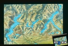
![[Mapporn] Map of Wakefield, county town of the West Riding of Yorkshire from 1823. [4158x3435] (#Map #Riding #Town #County #West #Yorkshire) - 1.4 MB Tags: county, map, riding, town, west, yorkshire (Pict. in My r/MAPS favs)](https://t.im9.eu/mapporn-map-of-wakefield-county-town-of-the-west-riding-of-yorkshire-from-1823-4158x3435.jpg) Pict. Northern Italy - Lake Region map (1919-1938).2886 (#Map #Lake #Italy #Northern #Region)Pict. 799×748 px
Pict. Northern Italy - Lake Region map (1919-1938).2886 (#Map #Lake #Italy #Northern #Region)Pict. 799×748 px★ 9581 pts. ♥ 0 aime ⬇ 8 sauvegardés
 Pict. [Mapporn] Map of an exploring expedition to the Rocky Mountains in the year 1842 and to Oregon & north California in the yea (#Year #Map #California #Rocky #Exploring #Yea #Expedition)Pict. 9000×5313 px
★ 7347 pts. ♥ 0 aime ⬇ 13 sauvegardés
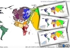
![[Mapporn] Map of an exploring expedition to the Rocky Mountains in the year 1842 and to Oregon & north California in the yea (#Year #Map #California #Rocky #Exploring #Yea #Expedition) - 3.8 MB Tags: california, expedition, exploring, map, mountains, north, oregon, rocky, yea, year (Pict. in My r/MAPS favs)](https://t.im9.eu/mapporn-map-of-an-exploring-expedition-to-the-rocky-mountains-in-the-year-1842-and-to-oregon-north-california-in-the-years-1843-44-john-c-fremont-big-9000-x-5313.jpg) GIF World Population Map Animation Years 1950-2100 (Population Change Animated Map) (#Animated #Years #Change #Population #Animation)GIF 620×292 px
GIF World Population Map Animation Years 1950-2100 (Population Change Animated Map) (#Animated #Years #Change #Population #Animation)GIF 620×292 px★ 6730 pts. ♥ 0 aime ⬇ 15 sauvegardés
 Pict. [Mapporn] Public Debt to GDP ratio map of European Union [834x642] (#Map #Public #Gdp #Ratio #Debt)Pict. 834×642 px
★ 6083 pts. ♥ 0 aime ⬇ 8 sauvegardés
![[Mapporn] Public Debt to GDP ratio map of European Union [834x642] (#Map #Public #Gdp #Ratio #Debt) - 93 KB Tags: debt, european, gdp, map, public, ratio, union (Pict. in My r/MAPS favs)](https://t.im9.eu/mapporn-public-debt-to-gdp-ratio-map-of-european-union-834x642.jpg) Pict. [Mapporn] I drew this map from memory. I haven't looked at a map in a few days, just travel a lot. [552 x 348] [OC] (#Map #Lot #Looked #Drew #Travel #Memory)Pict. 552×348 px
Pict. [Mapporn] I drew this map from memory. I haven't looked at a map in a few days, just travel a lot. [552 x 348] [OC] (#Map #Lot #Looked #Drew #Travel #Memory)Pict. 552×348 px★ 5325 pts. ♥ 0 aime ⬇ 7 sauvegardés
![[Mapporn] I drew this map from memory. I haven't looked at a map in a few days, just travel a lot. [552 x 348] [OC] (#Map #Lot #Looked #Drew #Travel #Memory) - 38 KB Tags: drew, looked, lot, map, memory, travel (Pict. in My r/MAPS favs)](https://t.im9.eu/mapporn-i-drew-this-map-from-memory-i-haven-t-looked-at-a-map-in-a-few-days-just-travel-a-lot-552-x-348-oc.jpg) Pict. [Mapporn] Map of Europe after a 216 foot sea level rise [2048x1536] (#Map #Europe #Level #2048x1536 #Rise)Pict. 2047×1535 px
Pict. [Mapporn] Map of Europe after a 216 foot sea level rise [2048x1536] (#Map #Europe #Level #2048x1536 #Rise)Pict. 2047×1535 px★ 6435 pts. ♥ 0 aime ⬇ 14 sauvegardés
![[Mapporn] Map of Europe after a 216 foot sea level rise [2048x1536] (#Map #Europe #Level #2048x1536 #Rise) - 452 KB Tags: 2048x1536, europe, foot, level, map, rise, sea (Pict. in My r/MAPS favs)](https://t.im9.eu/mapporn-map-of-europe-after-a-216-foot-sea-level-rise-2048x1536.jpg) Pict. [Mildlyinteresting] The new rug in our office lobby is a map of the city. The red dot is where we are located. (#Map #Red #City #Located #Lobby)Pict. 2203×2937 px
Pict. [Mildlyinteresting] The new rug in our office lobby is a map of the city. The red dot is where we are located. (#Map #Red #City #Located #Lobby)Pict. 2203×2937 px★ -11036 pts. ♥ 0 aime ⬇ 6 sauvegardés
![[Mildlyinteresting] The new rug in our office lobby is a map of the city. The red dot is where we are located. (#Map #Red #City #Located #Lobby) - 498 KB Tags: city, dot, lobby, located, map, office, red, rug (Pict. in My r/MILDLYINTERESTING favs)](https://t.im9.eu/mildlyinteresting-the-new-rug-in-our-office-lobby-is-a-map-of-the-city-the-red-dot-is-where-we-are-located.jpg) Pict. [Mapporn] Ethnographic Map and Statistics of Partitioned Poland, 1858 [2959×2432] (#Map #Poland #Statistics #Ethnographic #Partitioned)Pict. 2959×2432 px
Pict. [Mapporn] Ethnographic Map and Statistics of Partitioned Poland, 1858 [2959×2432] (#Map #Poland #Statistics #Ethnographic #Partitioned)Pict. 2959×2432 px★ 6235 pts. ♥ 0 aime ⬇ 5 sauvegardés
![[Mapporn] Ethnographic Map and Statistics of Partitioned Poland, 1858 [2959×2432] (#Map #Poland #Statistics #Ethnographic #Partitioned) - 748 KB Tags: ethnographic, map, partitioned, poland, statistics (Pict. in My r/MAPS favs)](https://t.im9.eu/mapporn-ethnographic-map-and-statistics-of-partitioned-poland-1858-2959-2432.jpg)