★ 4762 pts. ♥ 0 aime ⬇ 1 sauvegardés
![[Mapporn] Topographic hillshade map of Italy [2276x2644] (#Map #Italy #Topographic) - 1 MB Tags: italy, map, topographic (Pict. in My r/MAPS favs)](https://t.im9.eu/mapporn-topographic-hillshade-map-of-italy-2276x2644.jpg) Pict. [Mapporn] World Map with Administrative Divisions [4972x2517] (#World #Map #Divisions #Administrative)Pict. 4972×2517 px
Pict. [Mapporn] World Map with Administrative Divisions [4972x2517] (#World #Map #Divisions #Administrative)Pict. 4972×2517 px★ 5422 pts. ♥ 0 aime ⬇ 4 sauvegardés
![[Mapporn] World Map with Administrative Divisions [4972x2517] (#World #Map #Divisions #Administrative) - 1 MB Tags: administrative, divisions, map, world (Pict. in My r/MAPS favs)](https://t.im9.eu/mapporn-world-map-with-administrative-divisions-4972x2517.jpg) Pict. [Mapporn] 1909 Tram Map of London [2400x1503] (#Map #London #Tram)Pict. 2583×1874 px
Pict. [Mapporn] 1909 Tram Map of London [2400x1503] (#Map #London #Tram)Pict. 2583×1874 px★ 4330 pts. ♥ 0 aime ⬇ 4 sauvegardés
![[Mapporn] 1909 Tram Map of London [2400x1503] (#Map #London #Tram) - 1 MB Tags: london, map, tram (Pict. in My r/MAPS favs)](https://t.im9.eu/mapporn-1909-tram-map-of-london-2400x1503.jpg) Pict. [Mapporn] A denim world map [1920x1440] (#World #Map #Denim #1920x1440)Pict. 1920×1440 px
Pict. [Mapporn] A denim world map [1920x1440] (#World #Map #Denim #1920x1440)Pict. 1920×1440 px★ 5041 pts. ♥ 0 aime ⬇ 7 sauvegardés
![[Mapporn] A denim world map [1920x1440] (#World #Map #Denim #1920x1440) - 1 MB Tags: 1920x1440, denim, map, world (Pict. in My r/MAPS favs)](https://t.im9.eu/mapporn-a-denim-world-map-1920x1440.jpg) Pict. [Gonewild] On-Off in my Map o[f] Middle Earth dress. 1 (#Map #Dress #Earth)Pict. 3264×3264 px
Pict. [Gonewild] On-Off in my Map o[f] Middle Earth dress. 1 (#Map #Dress #Earth)Pict. 3264×3264 px★ 11k pts. ♥ 0 aime ⬇ 4 sauvegardés
![[Gonewild] On-Off in my Map o[f] Middle Earth dress. 1 (#Map #Dress #Earth) - 1 MB Tags: dress, earth, map (Pict. in My r/GONEWILD favs)](https://t.im9.eu/gonewild-on-off-in-my-map-o-f-middle-earth-dress-1.jpg) Pict. [Mapporn] Railroad Map of Kyoto by Hiroshi Yoshida (1928) [2000x1899] (#Map #Railroad #Kyoto)Pict. 2000×1899 px
Pict. [Mapporn] Railroad Map of Kyoto by Hiroshi Yoshida (1928) [2000x1899] (#Map #Railroad #Kyoto)Pict. 2000×1899 px★ 4375 pts. ♥ 0 aime ⬇ 3 sauvegardés
![[Mapporn] Railroad Map of Kyoto by Hiroshi Yoshida (1928) [2000x1899] (#Map #Railroad #Kyoto) - 1 MB Tags: kyoto, map, railroad (Pict. in My r/MAPS favs)](https://t.im9.eu/mapporn-railroad-map-of-kyoto-by-hiroshi-yoshida-1928-2000x1899.jpg) Pict. [Mapporn] 1650 map of the world as it was known to the ancients by Jan Janssonius [2,100 x 1,657] (#World #Map #Jan #Ancients #Janssonius)Pict. 2100×1657 px
Pict. [Mapporn] 1650 map of the world as it was known to the ancients by Jan Janssonius [2,100 x 1,657] (#World #Map #Jan #Ancients #Janssonius)Pict. 2100×1657 px★ 5450 pts. ♥ 0 aime ⬇ 7 sauvegardés
![[Mapporn] 1650 map of the world as it was known to the ancients by Jan Janssonius [2,100 x 1,657] (#World #Map #Jan #Ancients #Janssonius) - 1 MB Tags: ancients, jan, janssonius, map, world (Pict. in My r/MAPS favs)](https://t.im9.eu/mapporn-1650-map-of-the-world-as-it-was-known-to-the-ancients-by-jan-janssonius-2-100-x-1-657.jpg) Pict. [Mapporn] Nuremberg Map of Tenochtitlan, 1524. [3,029x1,931] (#Map #Nuremberg )Pict. 3029×1931 px
Pict. [Mapporn] Nuremberg Map of Tenochtitlan, 1524. [3,029x1,931] (#Map #Nuremberg )Pict. 3029×1931 px★ 4177 pts. ♥ 0 aime ⬇ 4 sauvegardés
![[Mapporn] Nuremberg Map of Tenochtitlan, 1524. [3,029x1,931] (#Map #Nuremberg ) - 1 MB Tags: map, nuremberg (Pict. in My r/MAPS favs)](https://t.im9.eu/mapporn-nuremberg-map-of-tenochtitlan-1524-3-029x1-931.jpg) Pict. [Mapporn] Map of the World's Countries if they were Planets with the Same Surface Area [OC] [1960x7439] (#World #Map #Countries #Area #Surface #Planets)Pict. 1980×7439 px
Pict. [Mapporn] Map of the World's Countries if they were Planets with the Same Surface Area [OC] [1960x7439] (#World #Map #Countries #Area #Surface #Planets)Pict. 1980×7439 px★ 5497 pts. ♥ 0 aime ⬇ 14 sauvegardés
![[Mapporn] Map of the World's Countries if they were Planets with the Same Surface Area [OC] [1960x7439] (#World #Map #Countries #Area #Surface #Planets) - 1 MB Tags: area, countries, map, planets, surface, world (Pict. in My r/MAPS favs)](https://t.im9.eu/mapporn-map-of-the-world-s-countries-if-they-were-planets-with-the-same-surface-area-oc-1960x7439.jpg) Pict. [Mapporn] World-Wide Air Traffic Routes[4000x2875](Web-Map in comments) (#Wallpaper #Beautiful #World #Web #Traffic #Routes)Pict. 4000×2875 px
Pict. [Mapporn] World-Wide Air Traffic Routes[4000x2875](Web-Map in comments) (#Wallpaper #Beautiful #World #Web #Traffic #Routes)Pict. 4000×2875 px★ 6486 pts. ♥ 0 aime ⬇ 3 sauvegardés
![[Mapporn] World-Wide Air Traffic Routes[4000x2875](Web-Map in comments) (#Wallpaper #Beautiful #World #Web #Traffic #Routes) - 1023 KB Tags: air, beautiful, map, routes, traffic, wallpaper, web, wide, world (Pict. in My r/MAPS favs)](https://t.im9.eu/mapporn-world-wide-air-traffic-routes-4000x2875-web-map-in-comments.jpg) Pict. [Mapporn] John Speed's 1610 map of Suffolk [2000X1519] (#Map #John #Speed)Pict. 2000×1519 px
Pict. [Mapporn] John Speed's 1610 map of Suffolk [2000X1519] (#Map #John #Speed)Pict. 2000×1519 px★ 4208 pts. ♥ 0 aime ⬇ 3 sauvegardés
![[Mapporn] John Speed's 1610 map of Suffolk [2000X1519] (#Map #John #Speed) - 1023 KB Tags: john, map, speed (Pict. in My r/MAPS favs)](https://t.im9.eu/mapporn-john-speed-s-1610-map-of-suffolk-2000x1519.jpg) Pict. [Mapporn] Southamerica (1710) [3067x2100] (#Map #Europe #Average #Highres #Maps)Pict. 1890×2760 px
Pict. [Mapporn] Southamerica (1710) [3067x2100] (#Map #Europe #Average #Highres #Maps)Pict. 1890×2760 px★ 5018 pts. ♥ 0 aime ⬇ 4 sauvegardés
![[Mapporn] Southamerica (1710) [3067x2100] (#Map #Europe #Average #Highres #Maps) - 1019 KB Tags: average, europe, highres, map, maps (Pict. in My r/MAPS favs)](https://t.im9.eu/mapporn-southamerica-1710-3067x2100.jpg) Pict. [Mapporn] Map of the Colorado-Big Thompson Project, the largest trans-basin water supply system in Colorado [3794x2431] (#Big #Map #Water #Largest #Basin #Supply)Pict. 3794×2431 px
Pict. [Mapporn] Map of the Colorado-Big Thompson Project, the largest trans-basin water supply system in Colorado [3794x2431] (#Big #Map #Water #Largest #Basin #Supply)Pict. 3794×2431 px★ 6584 pts. ♥ 0 aime ⬇ 5 sauvegardés
![[Mapporn] Map of the Colorado-Big Thompson Project, the largest trans-basin water supply system in Colorado [3794x2431] (#Big #Map #Water #Largest #Basin #Supply) - 1019 KB Tags: basin, big, colorado, largest, map, project, supply, system, water (Pict. in My r/MAPS favs)](https://t.im9.eu/mapporn-map-of-the-colorado-big-thompson-project-the-largest-trans-basin-water-supply-system-in-colorado-3794x2431.jpg) Pict. [Mapporn] Map of named Glacial Erratics of North America, Geological Society of America, 1945. [2997x1195] (#Map #North #Society #Glacial #Geological)Pict. 2997×1195 px
Pict. [Mapporn] Map of named Glacial Erratics of North America, Geological Society of America, 1945. [2997x1195] (#Map #North #Society #Glacial #Geological)Pict. 2997×1195 px★ 6414 pts. ♥ 0 aime ⬇ 9 sauvegardés
![[Mapporn] Map of named Glacial Erratics of North America, Geological Society of America, 1945. [2997x1195] (#Map #North #Society #Glacial #Geological) - 1018 KB Tags: america, geological, glacial, map, named, north, society (Pict. in My r/MAPS favs)](https://t.im9.eu/mapporn-map-of-named-glacial-erratics-of-north-america-geological-society-of-america-1945-2997x1195.jpg) Pict. [Mapporn] World Religion Map by National Subdivision [4432x2144][OC] (#World #Map #National #Religion #Subdivision)Pict. 4432×2144 px
Pict. [Mapporn] World Religion Map by National Subdivision [4432x2144][OC] (#World #Map #National #Religion #Subdivision)Pict. 4432×2144 px★ 5918 pts. ♥ 0 aime ⬇ 4 sauvegardés
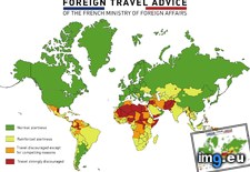
![[Mapporn] World Religion Map by National Subdivision [4432x2144][OC] (#World #Map #National #Religion #Subdivision) - 1011 KB Tags: map, national, religion, subdivision, world (Pict. in My r/MAPS favs)](https://t.im9.eu/mapporn-world-religion-map-by-national-subdivision-4432x2144-oc.jpg) Pict. mapporn-foreign-travel-advice-of-the-french-ministry-of-foreign-affairs-5600-4130-oc (#French #World #Map #Europe #Usa #Asia #Foreign #Geography #Stats #Affairs #Ministry)Pict. 5600×4137 px
Pict. mapporn-foreign-travel-advice-of-the-french-ministry-of-foreign-affairs-5600-4130-oc (#French #World #Map #Europe #Usa #Asia #Foreign #Geography #Stats #Affairs #Ministry)Pict. 5600×4137 px★ 9024 pts. ♥ 0 aime ⬇ 4 sauvegardés
 Pict. [Mapporn] 'Scene of fighting from 28 Dec to 19 Jan.' Hand drawn map of advance out of Bastogne by Lt. John Plumb [2187 x 3675] - (#Map #Hand #Scene #Bastogne #Fighting #Jan #Plumb)Pict. 2187×3675 px
★ 6993 pts. ♥ 0 aime ⬇ 5 sauvegardés
![[Mapporn] 'Scene of fighting from 28 Dec to 19 Jan.' Hand drawn map of advance out of Bastogne by Lt. John Plumb [2187 x 3675] - (#Map #Hand #Scene #Bastogne #Fighting #Jan #Plumb) - 1010 KB Tags: advance, bastogne, dec, drawn, fighting, hand, jan, john, map, plumb, scene (Pict. in My r/MAPS favs)](https://t.im9.eu/mapporn-scene-of-fighting-from-28-dec-to-19-jan-hand-drawn-map-of-advance-out-of-bastogne-by-lt-john-plumb-2187-x-3675-see-corresponding-service-record-in-comments-x-post-from-r-historyporn.jpg) Pict. [Mapporn] My latest creation. A Tolkien-style map of New Zealand. [2448x3264] (#Map #Style #Zealand #Latest #Creation #Tolkien)Pict. 2448×3264 px
Pict. [Mapporn] My latest creation. A Tolkien-style map of New Zealand. [2448x3264] (#Map #Style #Zealand #Latest #Creation #Tolkien)Pict. 2448×3264 px★ 5763 pts. ♥ 0 aime ⬇ 5 sauvegardés
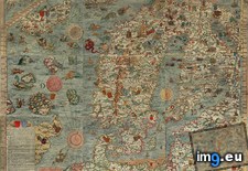
![[Mapporn] My latest creation. A Tolkien-style map of New Zealand. [2448x3264] (#Map #Style #Zealand #Latest #Creation #Tolkien) - 1009 KB Tags: creation, latest, map, style, tolkien, zealand (Pict. in My r/MAPS favs)](https://t.im9.eu/mapporn-my-latest-creation-a-tolkien-style-map-of-new-zealand-2448x3264.jpg) Pict. mapporn-carta-marina-the-earliest-somewhat-accurate-map-of-the-north-2006-1486 (#White #Map #Wide #Europe #North #Marina #Stats #Statistics #Carta #Earliest)Pict. 2006×1486 px
Pict. mapporn-carta-marina-the-earliest-somewhat-accurate-map-of-the-north-2006-1486 (#White #Map #Wide #Europe #North #Marina #Stats #Statistics #Carta #Earliest)Pict. 2006×1486 px★ 8372 pts. ♥ 0 aime ⬇ 2 sauvegardés
 Pict. [Mapporn] Linguistic map of Russian languagues from 1914, with some 2014 borders for reference [2438x2893] (#Map #Russian #Borders #Linguistic #Reference)Pict. 2194×2604 px
★ 6010 pts. ♥ 0 aime ⬇ 10 sauvegardés
![[Mapporn] Linguistic map of Russian languagues from 1914, with some 2014 borders for reference [2438x2893] (#Map #Russian #Borders #Linguistic #Reference) - 1002 KB Tags: borders, linguistic, map, reference, russian (Pict. in My r/MAPS favs)](https://t.im9.eu/mapporn-linguistic-map-of-russian-languagues-from-1914-with-some-2014-borders-for-reference-2438x2893.jpg) Pict. [Mapporn] The 1838 Bradford map of the state of Virginia [2100x1627] (#Map #State #Virginia)Pict. 2100×1627 px
Pict. [Mapporn] The 1838 Bradford map of the state of Virginia [2100x1627] (#Map #State #Virginia)Pict. 2100×1627 px★ 4660 pts. ♥ 0 aime ⬇ 5 sauvegardés
![[Mapporn] The 1838 Bradford map of the state of Virginia [2100x1627] (#Map #State #Virginia) - 999 KB Tags: map, state, virginia (Pict. in My r/MAPS favs)](https://t.im9.eu/mapporn-the-1838-bradford-map-of-the-state-of-virginia-2100x1627.jpg) Pict. [Mapporn] Population Dot Map of Washington State (and a part of Idaho, Oregon, and British Columbia) [OC] [4367x3127] (#Part #Map #State #Washington #Columbia #Dot #Idaho)Pict. 4367×3127 px
Pict. [Mapporn] Population Dot Map of Washington State (and a part of Idaho, Oregon, and British Columbia) [OC] [4367x3127] (#Part #Map #State #Washington #Columbia #Dot #Idaho)Pict. 4367×3127 px★ 7371 pts. ♥ 0 aime ⬇ 6 sauvegardés
![[Mapporn] Population Dot Map of Washington State (and a part of Idaho, Oregon, and British Columbia) [OC] [4367x3127] (#Part #Map #State #Washington #Columbia #Dot #Idaho) - 997 KB Tags: british, columbia, dot, idaho, map, oregon, part, population, state, washington (Pict. in My r/MAPS favs)](https://t.im9.eu/mapporn-population-dot-map-of-washington-state-and-a-part-of-idaho-oregon-and-british-columbia-oc-4367x3127.jpg) Pict. [Mapporn] 'Map of the heavens and the earth,' 1699 - A map showing the round world centered at the North Pole [2477x1747] (#World #Map #Earth #Pole #Heavens)Pict. 2477×1747 px
Pict. [Mapporn] 'Map of the heavens and the earth,' 1699 - A map showing the round world centered at the North Pole [2477x1747] (#World #Map #Earth #Pole #Heavens)Pict. 2477×1747 px★ 6005 pts. ♥ 0 aime ⬇ 4 sauvegardés
![[Mapporn] 'Map of the heavens and the earth,' 1699 - A map showing the round world centered at the North Pole [2477x1747] (#World #Map #Earth #Pole #Heavens) - 996 KB Tags: earth, heavens, map, north, pole, showing, world (Pict. in My r/MAPS favs)](https://t.im9.eu/mapporn-map-of-the-heavens-and-the-earth-1699-a-map-showing-the-round-world-centered-at-the-north-pole-2477x1747.jpg) Pict. [Mapporn] 1780 map of eastern Spain, with Don Quixote's route drawn in [5027x3295] (#Map #Drawn #Spain #Route #Eastern)Pict. 2514×1648 px
Pict. [Mapporn] 1780 map of eastern Spain, with Don Quixote's route drawn in [5027x3295] (#Map #Drawn #Spain #Route #Eastern)Pict. 2514×1648 px★ 5145 pts. ♥ 0 aime ⬇ 3 sauvegardés
![[Mapporn] 1780 map of eastern Spain, with Don Quixote's route drawn in [5027x3295] (#Map #Drawn #Spain #Route #Eastern) - 993 KB Tags: drawn, eastern, map, route, spain (Pict. in My r/MAPS favs)](https://t.im9.eu/mapporn-1780-map-of-eastern-spain-with-don-quixote-s-route-drawn-in-5027x3295.jpg)