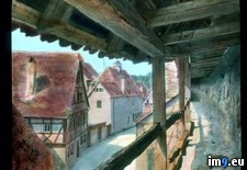
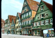
Pict. Rothenburg ob der Tauber - medieval town wall near the Kobolzell Gate, roofed walkway (1930).1871 (#Town #Wall #Gate #Walkway #Roofed #Kobolzell)Pict. 799×748 px Pict. Dinkelsbuhl - gable-roofed houses with ground-floor shops (1930).1823 (#Floor #Houses #Dinkelsbuhl #Roofed #Gable)Pict. 799×748 px
 Pict. Monterey County, California. 17-Mile Drive - view with tile-roofed house (1920-1940).1394 (#California #House #County #Tile #Roofed)Pict. 799×780 px
 Pict. [Mapporn] Map of the Great Victorian Way, a proposed loop around central London composed of glass-roofed streets, shops and rail (#Great #Map #Way #London #Rail #Victorian #Proposed #Loop #Roofed)Pict. 957×600 px
![[Mapporn] Map of the Great Victorian Way, a proposed loop around central London composed of glass-roofed streets, shops and rail (#Great #Map #Way #London #Rail #Victorian #Proposed #Loop #Roofed) - 134 KB Tags: central, glass, great, london, loop, map, proposed, rail, roofed, shops, streets, victorian, way (Pict. in My r/MAPS favs)](https://t.im9.eu/mapporn-map-of-the-great-victorian-way-a-proposed-loop-around-central-london-composed-of-glass-roofed-streets-shops-and-railways-from-1856-956x600.jpg)
★ 10k pts. ♥ 0 aime ⬇ 12 sauvegardés
 Pict. Dinkelsbuhl - gable-roofed houses with ground-floor shops (1930).1823 (#Floor #Houses #Dinkelsbuhl #Roofed #Gable)Pict. 799×748 px
★ 10k pts. ♥ 0 aime ⬇ 8 sauvegardés
 Pict. Monterey County, California. 17-Mile Drive - view with tile-roofed house (1920-1940).1394 (#California #House #County #Tile #Roofed)Pict. 799×780 px
★ 10k pts. ♥ 0 aime ⬇ 2 sauvegardés
 Pict. [Mapporn] Map of the Great Victorian Way, a proposed loop around central London composed of glass-roofed streets, shops and rail (#Great #Map #Way #London #Rail #Victorian #Proposed #Loop #Roofed)Pict. 957×600 px
★ 8319 pts. ♥ 0 aime ⬇ 9 sauvegardés
![[Mapporn] Map of the Great Victorian Way, a proposed loop around central London composed of glass-roofed streets, shops and rail (#Great #Map #Way #London #Rail #Victorian #Proposed #Loop #Roofed) - 134 KB Tags: central, glass, great, london, loop, map, proposed, rail, roofed, shops, streets, victorian, way (Pict. in My r/MAPS favs)](https://t.im9.eu/mapporn-map-of-the-great-victorian-way-a-proposed-loop-around-central-london-composed-of-glass-roofed-streets-shops-and-railways-from-1856-956x600.jpg)