★ 5983 pts. ♥ 0 aime ⬇ 3 sauvegardés
![[Mapporn] Map of the Eastern Bloc at the height of Communist Rule In Europe [1024 x 1014] [OC] (#Map #Europe #Height #Communist #Bloc) - 129 KB Tags: bloc, communist, eastern, europe, height, map, rule (Pict. in My r/MAPS favs)](https://t.im9.eu/mapporn-map-of-the-eastern-bloc-at-the-height-of-communist-rule-in-europe-1024-x-1014-oc.jpg) Pict. [Mapporn] Average Yearly Snowfall Map of Connecticut [2000 x 1600] (#Map #Average #Connecticut #Snowfall #Yearly)Pict. 2000×1600 px
Pict. [Mapporn] Average Yearly Snowfall Map of Connecticut [2000 x 1600] (#Map #Average #Connecticut #Snowfall #Yearly)Pict. 2000×1600 px★ 5413 pts. ♥ 0 aime ⬇ 3 sauvegardés
![[Mapporn] Average Yearly Snowfall Map of Connecticut [2000 x 1600] (#Map #Average #Connecticut #Snowfall #Yearly) - 234 KB Tags: average, connecticut, map, snowfall, yearly (Pict. in My r/MAPS favs)](https://t.im9.eu/mapporn-average-yearly-snowfall-map-of-connecticut-2000-x-1600.jpg) Pict. [Mapporn] Ireland’s ‘oldest known separate map’ (First map to show Ireland not just part of British Isles) expected to fetch €3 (#Part #Show #Map #Oldest #Fetch #Separate #Isles)Pict. 620×330 px
Pict. [Mapporn] Ireland’s ‘oldest known separate map’ (First map to show Ireland not just part of British Isles) expected to fetch €3 (#Part #Show #Map #Oldest #Fetch #Separate #Isles)Pict. 620×330 px★ 6915 pts. ♥ 0 aime ⬇ 4 sauvegardés
![[Mapporn] Ireland’s ‘oldest known separate map’ (First map to show Ireland not just part of British Isles) expected to fetch €3 (#Part #Show #Map #Oldest #Fetch #Separate #Isles) - 51 KB Tags: british, expected, fetch, ireland, isles, map, oldest, part, separate, show (Pict. in My r/MAPS favs)](https://t.im9.eu/mapporn-ireland-s-oldest-known-separate-map-first-map-to-show-ireland-not-just-part-of-british-isles-expected-to-fetch-3-million-article-in-comments-620x330.jpg) Pict. [Mapporn] Ottoman Map of Africa [1600x1310] (#Map #Africa #Ottoman)Pict. 1600×1310 px
Pict. [Mapporn] Ottoman Map of Africa [1600x1310] (#Map #Africa #Ottoman)Pict. 1600×1310 px★ 4767 pts. ♥ 0 aime ⬇ 7 sauvegardés
![[Mapporn] Ottoman Map of Africa [1600x1310] (#Map #Africa #Ottoman) - 607 KB Tags: africa, map, ottoman (Pict. in My r/MAPS favs)](https://t.im9.eu/mapporn-ottoman-map-of-africa-1600x1310.jpg) Pict. Earth Map Dual Monitor Other HD Wallpaper (#Wallpaper #Map #Earth #Dual #Monitor)Pict. 2560×1024 px
Pict. Earth Map Dual Monitor Other HD Wallpaper (#Wallpaper #Map #Earth #Dual #Monitor)Pict. 2560×1024 px★ 105k pts. ♥ 0 aime ⬇ 11 sauvegardés
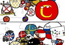
 Pict. Europe history (Polandball meme style flags maps) (#Map #Europe #Meme #Maps #Poland #Flags #Polandball)Pict. 560×6186 px
★ 8553 pts. ♥ 0 aime ⬇ 9 sauvegardés
 Pict. [Dataisbeautiful] 'It would be easier to feed the planet if more of the crops we grew ended up in human stomachs': map of the pr (#Map #Human #Grew #Easier #Crops #Stomachs)Pict. 1250×764 px
★ 4171 pts. ♥ 0 aime ⬇ 4 sauvegardés
![[Dataisbeautiful] 'It would be easier to feed the planet if more of the crops we grew ended up in human stomachs': map of the pr (#Map #Human #Grew #Easier #Crops #Stomachs) - 110 KB Tags: crops, easier, ended, feed, grew, human, map, planet, stomachs (Pict. in My r/DATAISBEAUTIFUL favs)](https://t.im9.eu/dataisbeautiful-it-would-be-easier-to-feed-the-planet-if-more-of-the-crops-we-grew-ended-up-in-human-stomachs-map-of-the-proportion-of-crops-that-are-used-directly-as-food-vs-fuel-or-animal-feed.jpg) Pict. [Dataisbeautiful] A Thermal Map for all Oregon Streams (links to better quality image, maps, tools, and data in thread) (#Image #Map #Quality #Links #Thermal #Streams #Tools)Pict. 1202×929 px
Pict. [Dataisbeautiful] A Thermal Map for all Oregon Streams (links to better quality image, maps, tools, and data in thread) (#Image #Map #Quality #Links #Thermal #Streams #Tools)Pict. 1202×929 px★ 4636 pts. ♥ 0 aime ⬇ 4 sauvegardés
![[Dataisbeautiful] A Thermal Map for all Oregon Streams (links to better quality image, maps, tools, and data in thread) (#Image #Map #Quality #Links #Thermal #Streams #Tools) - 534 KB Tags: data, image, links, map, maps, oregon, quality, streams, thermal, tools (Pict. in My r/DATAISBEAUTIFUL favs)](https://t.im9.eu/dataisbeautiful-a-thermal-map-for-all-oregon-streams-links-to-better-quality-image-maps-tools-and-data-in-thread.jpg) Pict. [Mapporn] Historical Map of the NYC Subway showing when each segment opened (1983) [2208x2340] (#Map #Showing #Nyc #Historical #Opened #Subway)Pict. 2208×2340 px
Pict. [Mapporn] Historical Map of the NYC Subway showing when each segment opened (1983) [2208x2340] (#Map #Showing #Nyc #Historical #Opened #Subway)Pict. 2208×2340 px★ 5650 pts. ♥ 0 aime ⬇ 5 sauvegardés
![[Mapporn] Historical Map of the NYC Subway showing when each segment opened (1983) [2208x2340] (#Map #Showing #Nyc #Historical #Opened #Subway) - 760 KB Tags: historical, map, nyc, opened, showing, subway (Pict. in My r/MAPS favs)](https://t.im9.eu/mapporn-historical-map-of-the-nyc-subway-showing-when-each-segment-opened-1983-2208x2340.jpg) Pict. [Mapporn] Map of christian kingdoms established via crusades [610x929] (#Map #Via #Established #610x929 #Crusades)Pict. 610×929 px
Pict. [Mapporn] Map of christian kingdoms established via crusades [610x929] (#Map #Via #Established #610x929 #Crusades)Pict. 610×929 px★ 6582 pts. ♥ 0 aime ⬇ 9 sauvegardés
![[Mapporn] Map of christian kingdoms established via crusades [610x929] (#Map #Via #Established #610x929 #Crusades) - 89 KB Tags: 610x929, christian, crusades, established, kingdoms, map, via (Pict. in My r/MAPS favs)](https://t.im9.eu/mapporn-map-of-christian-kingdoms-established-via-crusades-610x929.jpg) Pict. [Mapporn] A simple map showing the female Senators in each state [OC] [1650x982] (#Map #Female #Showing #State #Simple #Senators)Pict. 1650×982 px
Pict. [Mapporn] A simple map showing the female Senators in each state [OC] [1650x982] (#Map #Female #Showing #State #Simple #Senators)Pict. 1650×982 px★ 5744 pts. ♥ 0 aime ⬇ 6 sauvegardés
![[Mapporn] A simple map showing the female Senators in each state [OC] [1650x982] (#Map #Female #Showing #State #Simple #Senators) - 149 KB Tags: female, map, senators, showing, simple, state (Pict. in My r/MAPS favs)](https://t.im9.eu/mapporn-a-simple-map-showing-the-female-senators-in-each-state-oc-1650x982.jpg) Pict. [Mapporn] 'Map of the heavens and the earth,' 1699 - A map showing the round world centered at the North Pole [2477x1747] (#World #Map #Earth #Pole #Heavens)Pict. 2477×1747 px
Pict. [Mapporn] 'Map of the heavens and the earth,' 1699 - A map showing the round world centered at the North Pole [2477x1747] (#World #Map #Earth #Pole #Heavens)Pict. 2477×1747 px★ 5884 pts. ♥ 0 aime ⬇ 4 sauvegardés
![[Mapporn] 'Map of the heavens and the earth,' 1699 - A map showing the round world centered at the North Pole [2477x1747] (#World #Map #Earth #Pole #Heavens) - 996 KB Tags: earth, heavens, map, north, pole, showing, world (Pict. in My r/MAPS favs)](https://t.im9.eu/mapporn-map-of-the-heavens-and-the-earth-1699-a-map-showing-the-round-world-centered-at-the-north-pole-2477x1747.jpg) Pict. [Mapporn] World map resized by GDP, 1995 [1382x1078] (#World #Map #Gdp #Resized)Pict. 1382×1078 px
Pict. [Mapporn] World map resized by GDP, 1995 [1382x1078] (#World #Map #Gdp #Resized)Pict. 1382×1078 px★ 4469 pts. ♥ 0 aime ⬇ 3 sauvegardés
![[Mapporn] World map resized by GDP, 1995 [1382x1078] (#World #Map #Gdp #Resized) - 200 KB Tags: gdp, map, resized, world (Pict. in My r/MAPS favs)](https://t.im9.eu/mapporn-world-map-resized-by-gdp-1995-1382x1078.jpg) Pict. [Mapporn] A new map of the world on the globular projection (1857) [4000x2522] (#World #Map #Projection #Globular)Pict. 4000×2522 px
Pict. [Mapporn] A new map of the world on the globular projection (1857) [4000x2522] (#World #Map #Projection #Globular)Pict. 4000×2522 px★ 5217 pts. ♥ 0 aime ⬇ 7 sauvegardés
![[Mapporn] A new map of the world on the globular projection (1857) [4000x2522] (#World #Map #Projection #Globular) - 1.9 MB Tags: globular, map, projection, world (Pict. in My r/MAPS favs)](https://t.im9.eu/mapporn-a-new-map-of-the-world-on-the-globular-projection-1857-4000x2522.jpg) Pict. [Mapporn] Was inspired by the All Streets project and created a web-map of all the roads in the U.S. (zoomable map in comments) (#Map #Inspired #Web #Roads #Zoomable)Pict. 1414×780 px
Pict. [Mapporn] Was inspired by the All Streets project and created a web-map of all the roads in the U.S. (zoomable map in comments) (#Map #Inspired #Web #Roads #Zoomable)Pict. 1414×780 px★ 6411 pts. ♥ 0 aime ⬇ 5 sauvegardés
![[Mapporn] Was inspired by the All Streets project and created a web-map of all the roads in the U.S. (zoomable map in comments) (#Map #Inspired #Web #Roads #Zoomable) - 195 KB Tags: created, inspired, map, project, roads, streets, web, zoomable (Pict. in My r/MAPS favs)](https://t.im9.eu/mapporn-was-inspired-by-the-all-streets-project-and-created-a-web-map-of-all-the-roads-in-the-u-s-zoomable-map-in-comments-1414x780.jpg) Pict. [Mapporn] 1917 Official Map of South Carolina Showing the Public Highways [914x777] (#Map #Public #Carolina #Official #Highways)Pict. 914×777 px
Pict. [Mapporn] 1917 Official Map of South Carolina Showing the Public Highways [914x777] (#Map #Public #Carolina #Official #Highways)Pict. 914×777 px★ 5956 pts. ♥ 0 aime ⬇ 3 sauvegardés
![[Mapporn] 1917 Official Map of South Carolina Showing the Public Highways [914x777] (#Map #Public #Carolina #Official #Highways) - 250 KB Tags: carolina, highways, map, official, public, showing, south (Pict. in My r/MAPS favs)](https://t.im9.eu/mapporn-1917-official-map-of-south-carolina-showing-the-public-highways-914x777.jpg) Pict. [Mapporn] Enormous map of the Earth-facing side of the moon [3686x2582] (#Map #Earth #Moon #Enormous #Facing)Pict. 3686×2582 px
Pict. [Mapporn] Enormous map of the Earth-facing side of the moon [3686x2582] (#Map #Earth #Moon #Enormous #Facing)Pict. 3686×2582 px★ 5086 pts. ♥ 0 aime ⬇ 5 sauvegardés
![[Mapporn] Enormous map of the Earth-facing side of the moon [3686x2582] (#Map #Earth #Moon #Enormous #Facing) - 1.6 MB Tags: earth, enormous, facing, map, moon (Pict. in My r/MAPS favs)](https://t.im9.eu/mapporn-enormous-map-of-the-earth-facing-side-of-the-moon-3686x2582.jpg) Pict. [Mapporn] 1579 World Map 'Typus Orbus Terrarum' by Abraham Ortelius [2126x1499] (#World #Map #Abraham #Ortelius)Pict. 2126×1499 px
Pict. [Mapporn] 1579 World Map 'Typus Orbus Terrarum' by Abraham Ortelius [2126x1499] (#World #Map #Abraham #Ortelius)Pict. 2126×1499 px★ 5016 pts. ♥ 0 aime ⬇ 5 sauvegardés
![[Mapporn] 1579 World Map 'Typus Orbus Terrarum' by Abraham Ortelius [2126x1499] (#World #Map #Abraham #Ortelius) - 705 KB Tags: abraham, map, ortelius, world (Pict. in My r/MAPS favs)](https://t.im9.eu/mapporn-1579-world-map-typus-orbus-terrarum-by-abraham-ortelius-2126x1499.jpg) Pict. [Mapporn] Japanese World Map [7986x4002] (#Japanese #World #Map #7986x4002)Pict. 7986×4002 px
Pict. [Mapporn] Japanese World Map [7986x4002] (#Japanese #World #Map #7986x4002)Pict. 7986×4002 px★ 5046 pts. ♥ 0 aime ⬇ 3 sauvegardés
![[Mapporn] Japanese World Map [7986x4002] (#Japanese #World #Map #7986x4002) - 2.5 MB Tags: 7986x4002, japanese, map, world (Pict. in My r/MAPS favs)](https://t.im9.eu/mapporn-japanese-world-map-7986x4002.jpg) Pict. [Mapporn] Male-female literacy differential map [1650x950] (#Map #Female #Male #Literacy #Differential)Pict. 1650×950 px
Pict. [Mapporn] Male-female literacy differential map [1650x950] (#Map #Female #Male #Literacy #Differential)Pict. 1650×950 px★ 5738 pts. ♥ 0 aime ⬇ 8 sauvegardés
![[Mapporn] Male-female literacy differential map [1650x950] (#Map #Female #Male #Literacy #Differential) - 258 KB Tags: differential, female, literacy, male, map (Pict. in My r/MAPS favs)](https://t.im9.eu/mapporn-male-female-literacy-differential-map-1650x950.jpg) Pict. [Mapporn] Map of where 98% of Canadians live [1043x912] (#Map #Live #Canadians)Pict. 1388×1214 px
Pict. [Mapporn] Map of where 98% of Canadians live [1043x912] (#Map #Live #Canadians)Pict. 1388×1214 px★ 4391 pts. ♥ 0 aime ⬇ 5 sauvegardés
![[Mapporn] Map of where 98% of Canadians live [1043x912] (#Map #Live #Canadians) - 253 KB Tags: canadians, live, map (Pict. in My r/MAPS favs)](https://t.im9.eu/mapporn-map-of-where-98-of-canadians-live-1043x912.jpg) Pict. [Mapporn] A map of the Province of New York in 1776 [1,920 x 2,381] (#Map #York #Province)Pict. 1920×2381 px
Pict. [Mapporn] A map of the Province of New York in 1776 [1,920 x 2,381] (#Map #York #Province)Pict. 1920×2381 px★ 4299 pts. ♥ 0 aime ⬇ 3 sauvegardés
![[Mapporn] A map of the Province of New York in 1776 [1,920 x 2,381] (#Map #York #Province) - 883 KB Tags: map, province, york (Pict. in My r/MAPS favs)](https://t.im9.eu/mapporn-a-map-of-the-province-of-new-york-in-1776-1-920-x-2-381.jpg) Pict. [Mapporn] Australian national public transport map (Warning: huge image) [8440x9615] (#Image #Huge #Map #Australian #Transport #8440x9615)Pict. 8440×9615 px
Pict. [Mapporn] Australian national public transport map (Warning: huge image) [8440x9615] (#Image #Huge #Map #Australian #Transport #8440x9615)Pict. 8440×9615 px★ 7398 pts. ♥ 0 aime ⬇ 9 sauvegardés
![[Mapporn] Australian national public transport map (Warning: huge image) [8440x9615] (#Image #Huge #Map #Australian #Transport #8440x9615) - 4.1 MB Tags: 8440x9615, australian, huge, image, map, national, public, transport, warning (Pict. in My r/MAPS favs)](https://t.im9.eu/mapporn-australian-national-public-transport-map-warning-huge-image-8440x9615.jpg) Pict. [Mapporn] FCC Mobile 10 Mbps-768 kbps Deployment Map (2015 Broadband Progress Report-Alabama) [805X543] (#Map #Mobile #Report #Broadband #Deployment)Pict. 805×543 px
Pict. [Mapporn] FCC Mobile 10 Mbps-768 kbps Deployment Map (2015 Broadband Progress Report-Alabama) [805X543] (#Map #Mobile #Report #Broadband #Deployment)Pict. 805×543 px★ 6301 pts. ♥ 0 aime ⬇ 11 sauvegardés
![[Mapporn] FCC Mobile 10 Mbps-768 kbps Deployment Map (2015 Broadband Progress Report-Alabama) [805X543] (#Map #Mobile #Report #Broadband #Deployment) - 135 KB Tags: alabama, broadband, deployment, map, mobile, progress, report (Pict. in My r/MAPS favs)](https://t.im9.eu/mapporn-fcc-mobile-10-mbps-768-kbps-deployment-map-2015-broadband-progress-report-alabama-805x543.jpg)